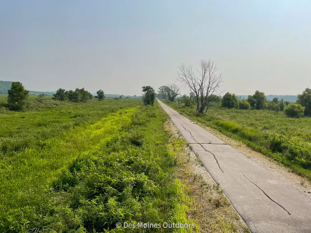
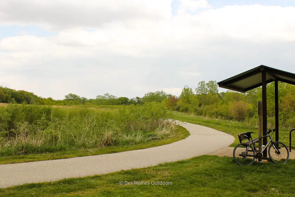
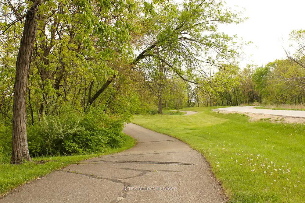
Neal Smith Trail is a 24.7-mile paved trail on Des Moines’ north side. It stretches through woodlands, prairie, and wetlands, with views of Saylorville Lake. These features combine to make it one of the most popular trails in the area!
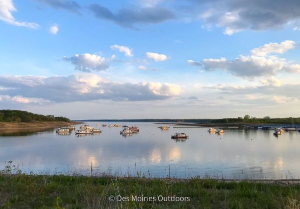
The trail starts in Des Moines and runs north to Saylorville Lake at Big Creek State Park.
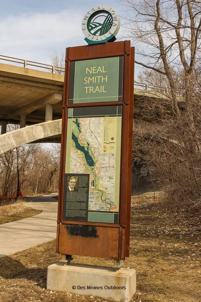
A Brief History of Neal Smith Trail
Neal Smith Trail was complete in 1982 and was one of the first trails in the Central Iowa Trail network.
It’s named after former US Congressman and native Iowan Neal Smith. Mr. Smith left office in 1995 as the longest-serving Congressman from Iowa (1959-1995). The Neal Smith Wildlife Refuge in Prairie City is also named after him for his role in its development.
The Trail
Neal Smith Trail is a designated National Recreational Trail. It’s one of the best-known trails in the Des Moines area, offering hills and curves not found on many Central Iowa Trails. Some challenging hills near the dam and marina give pedestrians and bikers a workout. And the mix of terrain—from woodlands and lakes to prairie and wetlands—is a unique feature of the trail.
In the warmer months, the trail gets used for hiking, biking, and running. And, in the winter, the section in the city of Des Moines gets plowed. The rest isn’t plowed and gets used for snowshoeing and cross-country skiing.*
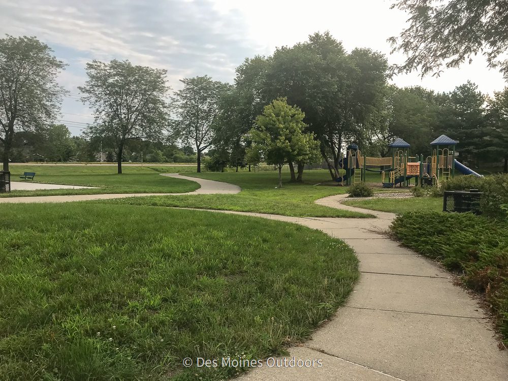
There are (so) many places to stop along Neal Smith trail! It goes through Birdland Park, Riverview Park, Saylorville Lake, and Big Creek State Park. Also, the Saylorville Lake Visitor Center, butterfly garden, and marina are along the trail.
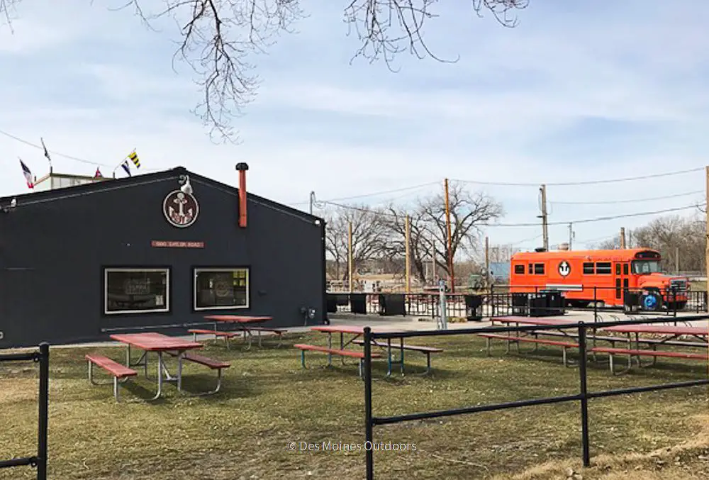
And if you’re looking for a place to grab a bite to eat, you could stop in at one of the many restaurants in downtown Des Moines. At Birdland Marina, you won’t want to miss Captain Roy’s! And if you’re in the Saylorville Marina area, check out Fleetwood, a newly renovated floating restaurant and bar. On the trail’s north end, Big Creek Marina concessions offer snacks for sale! You could also get off the path and head into Polk City or east to Ankeny to find more restaurants.
*Trail management is a shared effort. Thirteen miles of the trail get maintained by the US Army Corps of Engineers at Saylorville Lake. Other parts get managed by the City of Des Moines and the Iowa Department of Natural Resources.
Know before you go!
- Neal Smith is one of the area’s most used trails. It’s often busy, especially during weekends in the summer.
- Bikers consider it a perfect place to train for the RAGBRAI ride that takes place each July. The trail is teeming with bikers in the months before this ride.
- Between the Des Moines Botanical Garden and Birdland Marina in Des Moines, the trail is on the sidewalk along Pennsylvania Avenue. The sidewalk is a little rough on a bike.
- The trail shares the road through Cherry Glen Picnic Area, Prairie Flower Campground, and Saylorville Marina.
- If the river is flooding, parts of the trail are underwater! If the water level is over thirteen feet, parts of the route will be underwater. You can check river levels here. And check trail conditions for the Saylorville Lake area at the U.S. Army Corps of Engineers website.
Trail Map
Want more maps? Plan your route and find other trails on the Central Iowa Trails Interactive Map. Iowa By Trail also offers an interactive map that shows features along the trail.
Trail Access
Below, we’ll cover trail access points starting from Des Moines and heading north to Big Creek State Park. Check out our map (above) for specific locations. Please note that we do not track trail closures and conditions.
The trail’s south end is at East University Avenue in Des Moines, at the end of the John Pat Dorrian Trail. Parking is just south of here at the Des Moines Botanical Garden.
Just north of the Botanical Center (near Lutheran Hospital), the trail turns north on the sidewalk along Pennsylvania Avenue to Birdland Marina.
At Birdland Marina, the trail continues northwest along the river. You can park at Birdland Marina and access the trail there.

From there, the trail follows the river through the Riverview Park area. You can park at McHenry Park (Oak Park Ave.) and take the McHenry Park Trail south to get on Neal Smith Trail.
From there, the trail continues north and west, crossing I-35/80.
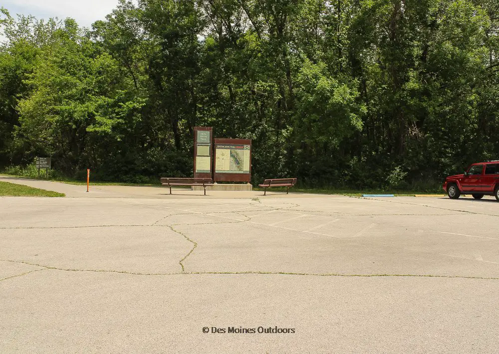
Further north, you can find parking and trail access off NW 66th Avenue at the Sycamore Access.
Next, the trail passes through Cottonwood Recreation Area (off NW 37th St., Johnston), where you can find more parking. North of here, a trail spur runs west to the Bob Shetler Campground below the dam (parking is available here).
Continuing north, a steep hill by the dam takes you to Saylorville Lake Visitor Center (8250 NW Horseshoe Road, Polk City). You can park at the Visitor Center and access the trail there.
The trail continues northeast, along Saylorville Lake’s shores to Red Feather Prairie (3700 NW 90th Ave, Polk City, IA 50226). There you can find parking for the trail and prairie area.
North of Red Feather Prairie, the trail extends through the Cherry Glen Picnic Area (NW 94th Ave). Here trail users share a road with vehicles. There is ample parking, picnic areas, water, and restrooms at the picnic area.
North of Cherry Glen, the trail passes east of the Oak Grove Beach and picnic area. Next, it enters Prairie Flower Campground (NW Lake Dr., Polk City). Use the roadway to head north through the campground (past registration and the group sites) to reaccess the trail. Parking is available at the campground.
North of here, the trail goes through the Saylorville Lake Marina roadway and parking lot (6170 NW Polk City Dr, Polk City). Reaccess the trail past the marina buildings on the west side of the road.
The trail then runs east to the Sandpiper Recreation Area (McBride Dr., off Hwy 415 in Polk City). Free parking is available along the trail. More parking, restrooms, picnic areas, and a beach are available in the day-use area, and fees apply.
From there, the trail heads northeast through Polk City. There is trail access with a parking area south of Highway 415 in Polk City, just west of Fareway and Casey’s.
The trail then runs north through Polk City residential areas. Scenic woodlands and several bridges take you to Big Creek State Park. There is a parking area on the southeast side of NW Big Creek Drive, near the park’s entrance.
Near the dam, the trail crosses to Big Creek Lake’s east shores and continues through the park. Several parking lots are along the road and near picnic shelters. The trail comes to an end at Big Creek Marina. Here you’ll find a beach, concessions, boat rental, a playground, and more.
Connecting Trails
The John Pat Dorrian Trail connects to Neal Smith Trail at E. University in Des Moines. It’s just north of the Greater Des Moines Botanical Center. John Pat Dorrian runs south along the Des Moines River, past downtown, to Pete Crivaro Park on E. Railroad Ave.
The Inter-Urban Trail connects to Neal Smith Trail north of the Riverview Park area. The Inter-Urban trestle bridge crosses the Des Moines River. It runs west to Beaverdale Park, along Urbandale Avenue, for ~1 mile.
The Trestle to Trestle Trail is off of the Inter-Urban trail near the trestle bridge on the river’s west side. It runs north 3.75 miles to the trestle bridge in Johnston and beyond. (The Johnston bridge is currently closed, work begins in 2022.)
Near Ankeny, you can get on the Oralabor Gateway Trail north of NW 66th Avenue and the Sycamore Access. In Ankeny, the Orlabor trail connects to the Gay Lea Wilson Trail. It will take you southeast to Pleasant Hill and then north to connect to the Chichaqua Valley Trail.
At the DMACC campus, you can head north from the Oralabor Gateway Trail to connect to the High Trestle Trail. It extends 25 miles north and west to Woodward, Iowa.
Neal Smith Trail Facts
- Location: From Des Moines to Big Creek State Park, along the Des Moines River and Saylorville Lake
- Distance: ~25 miles
- Surface: Asphalt
- Difficulty: Moderate (some challenging hills near the dam and marina, and a few blind curves)
- Description: Winds through woodlands, prairie, and wetlands, with rolling hills and lake views
- Trailheads: Several access points along the Des Moines River and Saylorville Lake (see above).
- Connectors: John Pat Dorrian Trail, Inter-Urban Trail, Trestle to Trestle Trail, Oralabor Gateway Trail
If you want more information and some views of the trail, check out this virtual tour of Saylorville Lake!
*We do not track all trail closures and conditions.