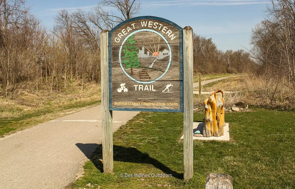
The Great Western Trail is a scenic 16.5-mile paved route from the bustling urban surroundings of Des Moines to the serene countryside of Martensdale.
It’s become a favorite among nature enthusiasts and avid cyclists alike! Along the trail, you’ll encounter diverse landscapes, including remnants of prairie and wetland, as well as woodlands and farmland.
So, whether you’re seeking a peaceful escape from the city or an invigorating outdoor adventure, the Great Western Trail has something for everyone.
A Brief History of the Great Western Trail
The trail follows a former railway from Des Moines, Iowa, to St. Joseph, Missouri. It got its name from the Chicago Great Western Company, which operated the railway from 1892 to 1968. You can still see some of the concrete rail markers along the route!
The trail opened in 1992 and was designated a National Recreation Trail in 2008.
The Trail
This trail is the perfect trail for, well, anyone! It passes through a ton of shade and various habitats, making it the ideal Iowa trail.
On the whole, it’s relatively flat, with some slight elevation gains. So whether you want a leisurely day on the trail or a straight path to pick up some speed, it won’t disappoint.
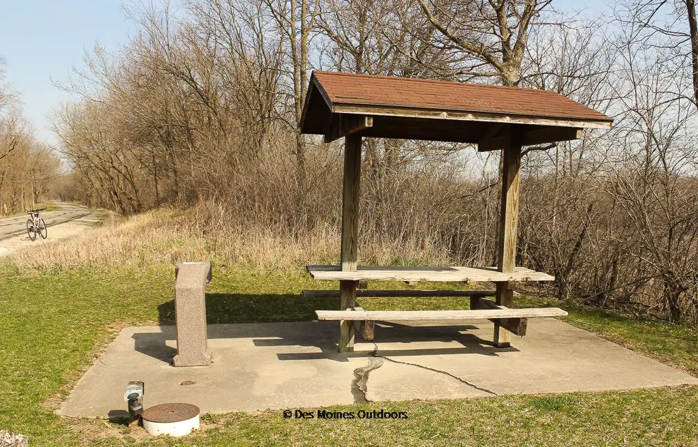
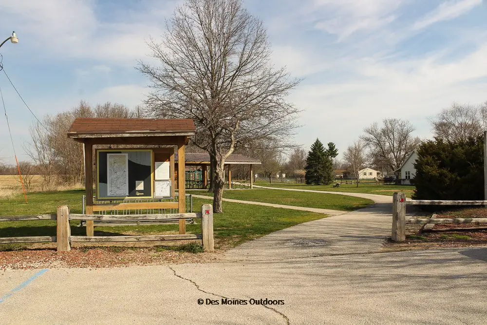
Besides its broad appeal, the trail has some excellent stopping points. You’ll find restaurants, picnic shelters, benches, and water along the route. Playgrounds are in Cumming and Martensdale.

Know Before You Go!
- The trail runs right through the middle of Willow Creek Golf Course in Des Moines!
- There are a few road crossings along the route, including gravel roads.
- Restrooms are at Des Moines Water Works Park, Cumming, and Martensdale
- Picnic shelters are at
- Des Moines Water Works Park
- Near Veteran’s Pkwy & Maffit Lake Road
- Cumming City Park
- Coolidge Street intersection south of Cumming
- Gear Street in Churchville, between Cumming and Martensdale
- Martensdale trailhead
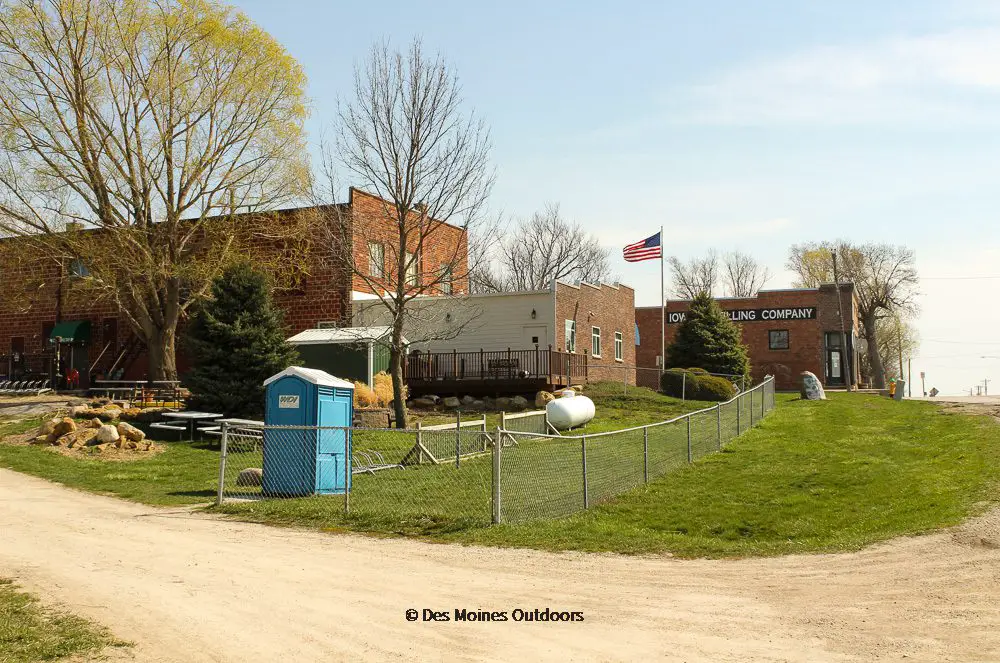
- Jethro’s Barbeque (Des Moines), The Chicken (Orilla), and the Cumming Tap (Cumming) are the main restaurants on the path. And the Iowa Distilling Company in Cumming has cocktails to go!
- The trail is under shared management by Polk and Warren County Conservation.
- Be cautious of cracks and bumps. It gets a little rough in spots further south.
- Between Des Moines and Cumming, the trail can get busy, especially on the weekends.
Trailheads
Several trailheads allow easy access to the trail! Below are the trailheads with parking. The two main trailheads are Des Moines on the north and Martensdale on the south.
Des Moines: Parking is across from the Izaak Walton League (4343 George Flagg Pkwy), south of Des Moines Water Works Park.
West Des Moines: A parking lot is off SE Pine/SW 72nd Avenue, southeast of Veteran’s Parkway & SE Pine.
Cumming: Parking is on the west edge of town, on the north side of the highway (Hwy G14).
Lida: There’s a gravel parking area at Fillmore Street and 33rd Avenue (gravel roads!), with room for 1-2 cars.
Martensdale: Parking is on the north side of Inwood Street/Iowa Avenue, near the football stadium. The trailhead has restrooms, a picnic shelter, and a playground.
Great Western Trail Map
Also, check out the Polk Co. Conservation brochure and Central Iowa Trails Interactive Map to help you plan your route.
Connecting Trail
The trail connects to Bill Riley Trail on the north trailhead near Des Moines Water Works Park. Take Bill Riley Trail north or east to access miles and miles of trails throughout Central Iowa. Going north, you’ll pass through Des Moines Water Works and connect to the Walnut Creek Trail. If you go east, you’ll go to Gray’s Lake. From there, you can connect to the downtown trails, including Principal Riverwalk.
Great Western Trail Facts
- Location: Des Moines to Martensdale, Iowa.
- Distance: 16.5 miles
- Surface: Asphalt
- Difficulty: Easy to Moderate (some slight elevation and curves)
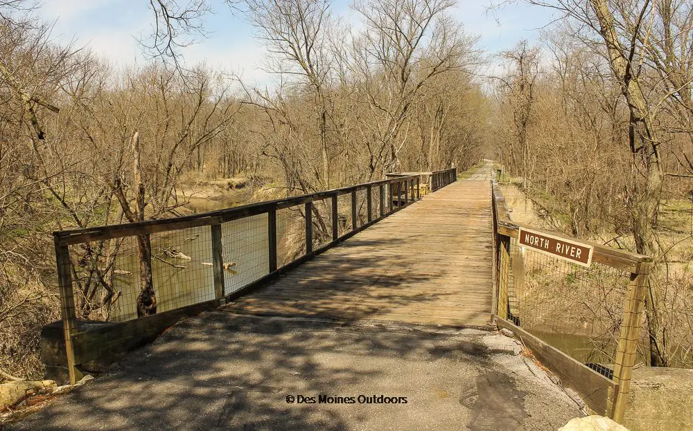
- Description: The trail follows a former railroad from Des Moines south to Martensdale. It passes through remnants of prairie and wetland, woodlands, and farmland and crosses the North River.
- Trailheads: Des Moines, West Des Moines, Cumming, and Martensdale
- Connectors: Bill Riley Trail