

If you love biking, Des Moines is the place to be! It’s a hub for thousands of miles of paved bike trails throughout Central Iowa. For a short peaceful ride or a multi-day adventure, Des Moines area bike trails won’t disappoint!
Des Moines Bike Trails
Below is a list of the major trails in and around Des Moines. But this list isn’t exhaustive. There are tons of street sidepaths and bike lanes throughout the area too. And most of the trails connect to others. Also, you can access several business and residential areas by bike. Use the bike trail maps to help you plan your route (see Maps section).
For more information on the trails listed, click on the trail name.
Trails Near Downtown Des Moines
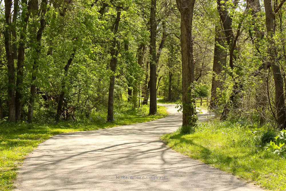
Bill Riley Trail. This 3-mile trail winds through trees and across the Raccoon River, southwest of downtown. It connects Greenwood-Ashworth Park to Des Moines Water Works and Gray’s Lake Parks. You’ll forget you’re in the city as you experience the woodland setting and wildlife on this trail!
Meredith Trail. This ~3-mile paved trail is a connector from Bill Riley Trail to downtown Des Moines. From the south side of Gray’s Lake, the trail follows the Raccoon River to its confluence with the Des Moines River. From there, it turns north and meets up with the Principal Riverwalk at Court Avenue. It connects to MLK Jr. Trail to form a 4-mile loop around the Raccoon River and Principal Park downtown.
Martin Luther King Jr. Trail. This 4-mile urban trail extends east-west along Martin Luther King Jr. Pkwy. It’s an essential part of the downtown Des Moines trail network. And it provides access to businesses and neighborhoods on MLK Jr. Parkway from Fleur Dr. to SE 30th Street.
Kruidenier Trail. This 2-mile loop trail surrounds Gray’s Lake. Its iconic pedestrian bridge, city views, and urban park setting make it a popular trail. Another great thing is, it gets illuminated at night! Connectors include Meredith and Bill Riley Trails.
Carl Voss Trail. This 4.7-mile paved trail extends southeast from Des Moines to Easter Lake! It has views of the river and downtown and is one of the newest sections of the central Iowa trails network. It connects to John Pat Dorrian and Meredith Trails on the south edge of downtown. At Easter Lake, it links to the Mark C Ackelson Trail that surrounds the lake.
John Pat Dorrian Trail. This 3.4-mile paved trail in the heart of downtown Des Moines extends along the east banks of the Des Moines River. It runs from East University Avenue south to Pete Crivaro Park. Between two downtown pedestrian bridges, the trail gets shared with the Principal Riverwalk. Connectors include Neal Smith Trail, MLK Jr. Trail, and Carl Voss trail.
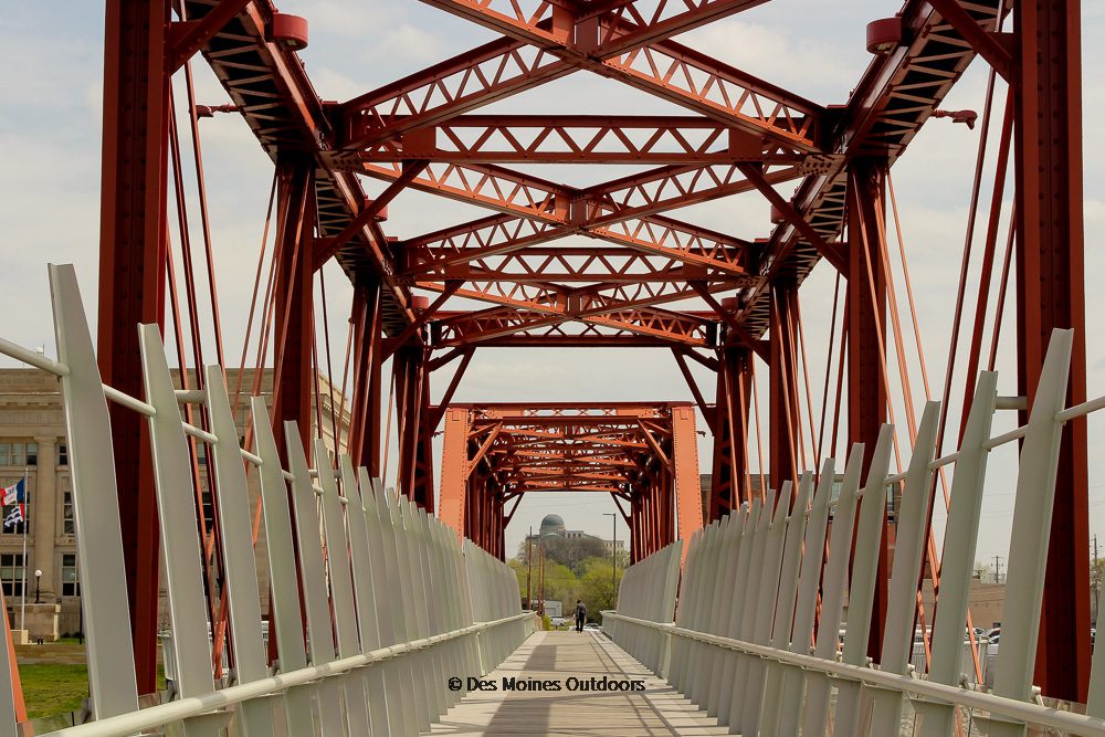
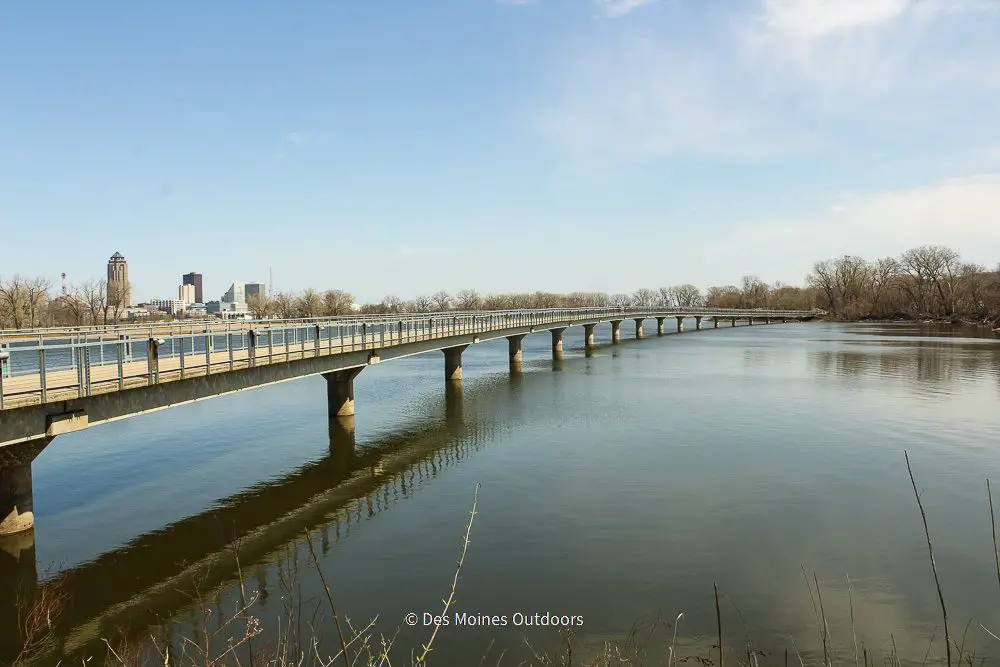
Principal Riverwalk. This 1.2-mile loop connects the east and west side of downtown Des Moines via two pedestrian bridges. It has a ton of things to do and links to hundreds of miles of paved trails! On the south end of the loop is the historic Des Moines Union Railway Bridge. From there, the trail extends north on both sides of the Des Moines River to the Iowa Women of Achievement Bridge.
Des Moines West
Walnut Creek Trail. This 3.2-mile creekside trail in Windsor Heights links Des Moines and the western suburbs. The trail extends along Walnut Creek from Colby Park to the Bill Riley Trail near Ashworth Park. The Clive Greenbelt Trail (north) and Bill Riley Trail (south) are connectors. And, if you’re looking for great dirt trails, check out Center Trails and Denman’s Woods. These mountain bike trails are off Walnut Creek Trail near North Valley Drive.
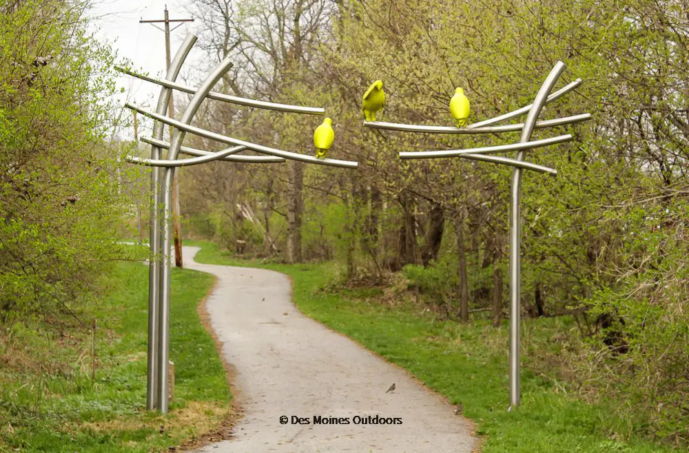
Clive Greenbelt Trail. This popular 7.9-mile trail winds along Walnut Creek from Windsor Heights to Clive. It totals 11.3 miles if you include all the connectors along the trail. Along the route, take in the art exhibit, and stop at your choice of parks and restaurants. It’s a trail you’ll go back to time and again. Connectors include Walnut Creek Trail, Raccoon River Valley Trail, and Heart of the Warrior Trail.
Raccoon River Valley Trail. This 89-mile trail spans four counties in Central Iowa, from Clive to Jefferson, including a 72-mile interior loop. You’ll find many excellent restaurants and things to see in the fourteen (14!) communities along the trail. Also, several stops offer a taste of railroad history. With so many places to explore, you can make a weekend of it!
Levee Trail. This ~3-mile trail is an important connector from West Des Moines to downtown Des Moines and beyond! It extends between Raccoon River Park in West Des Moines and the Walnut Creek Trail in Des Moines. Connectors include Jordan Creek Trail and Walnut Creek Trail.
Jordan Creek Trail. This 8-mile trail extends east-west through West Des Moines. It crosses neighborhoods and woodlands, with access to delicious restaurants and beautiful parks. Raccoon River Park is on the south end of the trail. Connectors include Grand Ave Trail and Levee Trail. The trail will soon join others for a 26.2-mile loop around West Des Moines as part of the Five Waters Project.
Grand Ave Trail. This ~3-mile trail follows Grand Avenue in West Des Moines, from Railroad & Grand southwest to around S. 50th St. It connects to Jordan Creek Trail – and is part of the Five Waters Project plans for a 26.2-mile loop.
Des Moines South
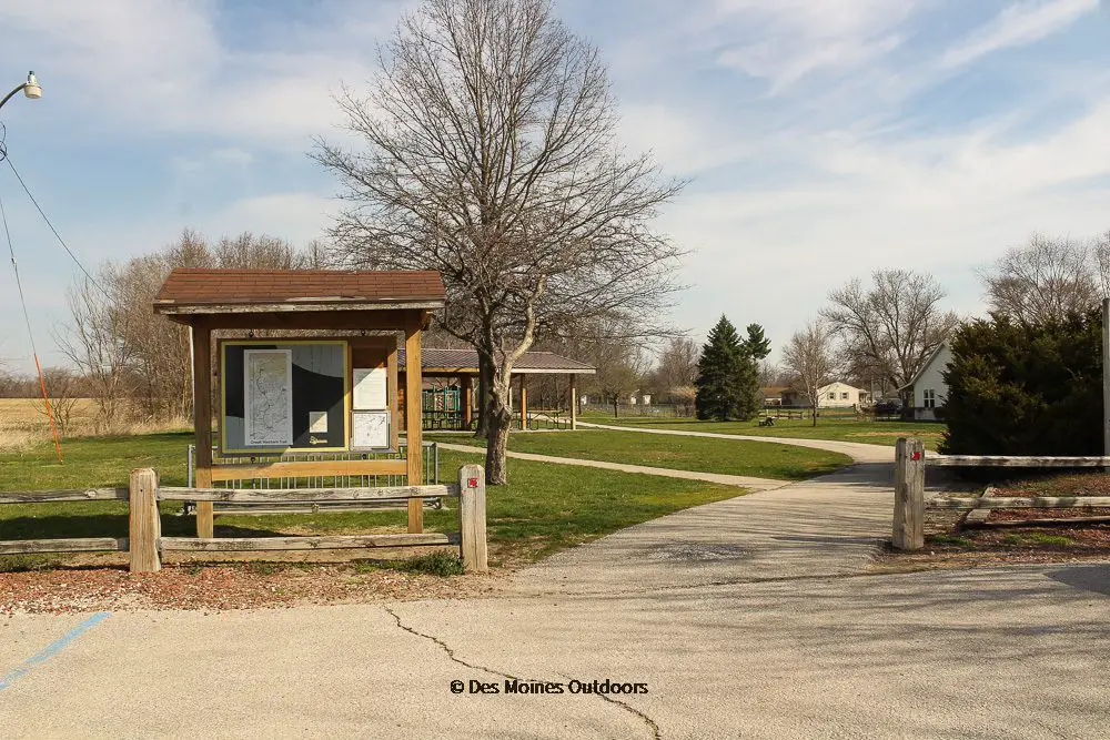
Great Western Trail. This scenic 16.5-mile route extends from urban Des Moines to rural Martensdale. It’s a popular trail, crossing remnants of prairie with wetlands, woodlands, and farmland along the way. You’ll find restaurants, picnic shelters, benches, and water along the route. It connects to Bill Riley Trail near Des Moines Water Works Park.
Summerset Trail. This beautiful 12-mile rail trail stretches from Carlisle to Indianola. It crosses through wetlands, woodlands, and prairie. And you won’t want to miss Banner Lakes at Summerset State Park, which is a midpoint on the trail. A pedestrian lane loops around the park, and there are a few miles of mountain bike trails there.
Des Moines East
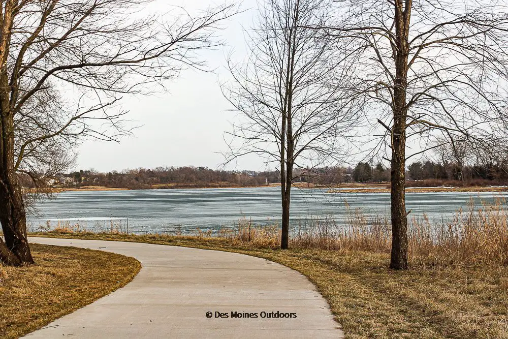
Mark C. Ackelson Trail. This 6-mile trail loops Easter Lake and has stunning lake views and unique bridges. A fishing pier, beach, boat rentals, playgrounds, hiking trails, and picnic areas are along the route. Connectors include Carl Voss Trail and Harry Piper Parkway (to Ewing Park).
Gay Lea Wilson Trail. This is a 21-mile trail is on the east side of Des Moines. It winds along Four Mile Creek, around Copper Creek Lake, and has many places to stop along the way! One segment extends from Ankeny to Des Moines, and another links Pleasant Hill to Altoona. It’s only partly complete and will eventually be 35 miles long and link to a 110-mile loop. Connecting trails include Oralabor Gateway Trail and Chichaqua Valley Trail.
Chichaqua Valley Trail. This 26-mile trail stretches from Berwick to Baxter. It’s a rail trail northeast of Des Moines that extends over farmland, creeks, and the Skunk River. Trail users enjoy the rail history and the small communities along the route! It connects to the Gay Lea Wilson Trail on the south.
We included Carl Voss Trail in the Downtown Des Moines section above. But it’s worth mentioning again since there is trail access at Easter Lake. From Easter Lake, you can take the trail 4.7 miles northwest to downtown Des Moines.
Des Moines North
Inter-Urban Trail. This 1.3-mile paved trail is just north of downtown Des Moines. It’s a historic route and a vital trail link between Beaverdale and other area trails. Connectors include the Neal Smith Trail and Trestle to Trestle Trail.
Trestle to Trestle Trail. This 3.75-mile paved trail on Des Moines’ north side connects two historic trestle bridges. It has a varied landscape, passing by the river, woodlands, and prairie. Also, it serves as a connector between Des Moines and Johnston. It links to the Inter-Urban Trail at its south end and Johnston city trails to the north.
Neal Smith Trail. This 25-mile trail stretches north from Des Moines to Saylorville Lake. It starts at E. University Ave and travels to Big Creek State Park in Polk City. Neal Smith is one of the best-known trails in the Des Moines area, offering hills and curves not found on many central Iowa trails. Some challenging hills near the dam and marina give bikers a workout. And the mix of terrain—from woodlands and lakes to prairie and wetlands—is a unique feature of the trail. Connectors include John Pat Dorrian Trail, Inter-Urban Trail, and Oralabor Gateway Trail.
Oralabor Gateway Trail. This 4.5-mile trail in Ankeny links the Gay Lea Wilson Trail to the Neal Smith Trail. It also provides access to the High Trestle Trail north of the DMACC Campus. The route runs near several businesses in Ankeny, including Kyle’s Bikes and a couple of restaurants.
High Trestle Trail. This 25-mile trail spans four Iowa counties on a former railway, from Ankeny to Woodward. Between Madrid and Woodward, it crosses the scenic Des Moines River Valley via a thirteen-story tall, ½-mile trestle bridge. The bridge is an artistic piece of rail history that lights up blue at night. The trail connects to the Oralabor Trail in Ankeny. Also, work is underway on a connector from Woodward to the Raccoon River Valley Trail in Perry.

Des Moines Bike Trail Maps
There are many helpful Des Moines bike trail maps out there. Below is a list of maps and more ways to find trail information.
- Des Moines Metro Planning Interactive Map
- Des Moines Road and Trail Closure Map
- Bike Collective Greater Des Moines Trail Map. Paper copies are available at the Des Moines Bike Collective Shop.
- Iowa By Trail (Iowa Natural Heritage Foundation)
- Iowa Bikes Interactive Map (Iowa Dept of Transportation). Order a map here.
More Biking Resources
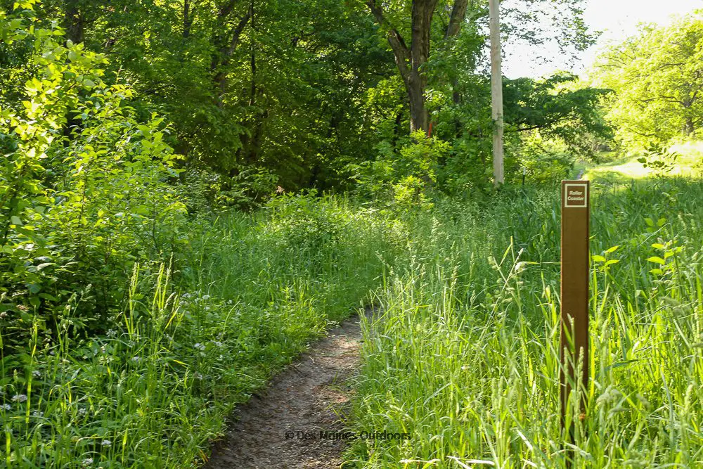
Des Moines Mountain Bike Trails
As you can see, the Des Moines area has hundreds of miles of paved bike trails! But those who like more of an off-road bicycling adventure have plenty of trail options too. Central Iowa Trails Association (CITA) develops and maintains singletrack mountain bike trails throughout Des Moines. Check out their map, and explore their website for events and trail information.
Did we miss something? Please let us know, and we’ll get it added!