Fort Des Moines Park is a beautiful 135-acre county park on the southeast side of Des Moines. It’s known for its historical significance and has a variety of outdoor activities!
Whether you hike the trails, fish or paddle the lake, or visit the arboretum, Fort Des Moines has many things to do. And it’s unique in many respects. From a stand of Aspen trees to its unique history, you won’t find another park like this in Des Moines.
A Brief History of Fort Des Moines
Talk about history! In 1901, the U.S. Army established Fort Des Moines as a training center on the city’s southeast side. Before World War I, it was the first Army Officers Training Camp for black officer trainees. During World War II, it also served as a training center for the U.S. Women’s Auxiliary Army Corps.
In 1949, Fort Des Moines became an Army Reserve Center. And until recently, it was a military entrance processing station (now located at Camp Dodge).
In the 1950s, the land around Fort Des Moines began to transfer to the city for development and public use. And in 1972, Polk County Conservation bought the land that is now Fort Des Moines Park.

Things To Do in Fort Des Moines Park
Hike the trails
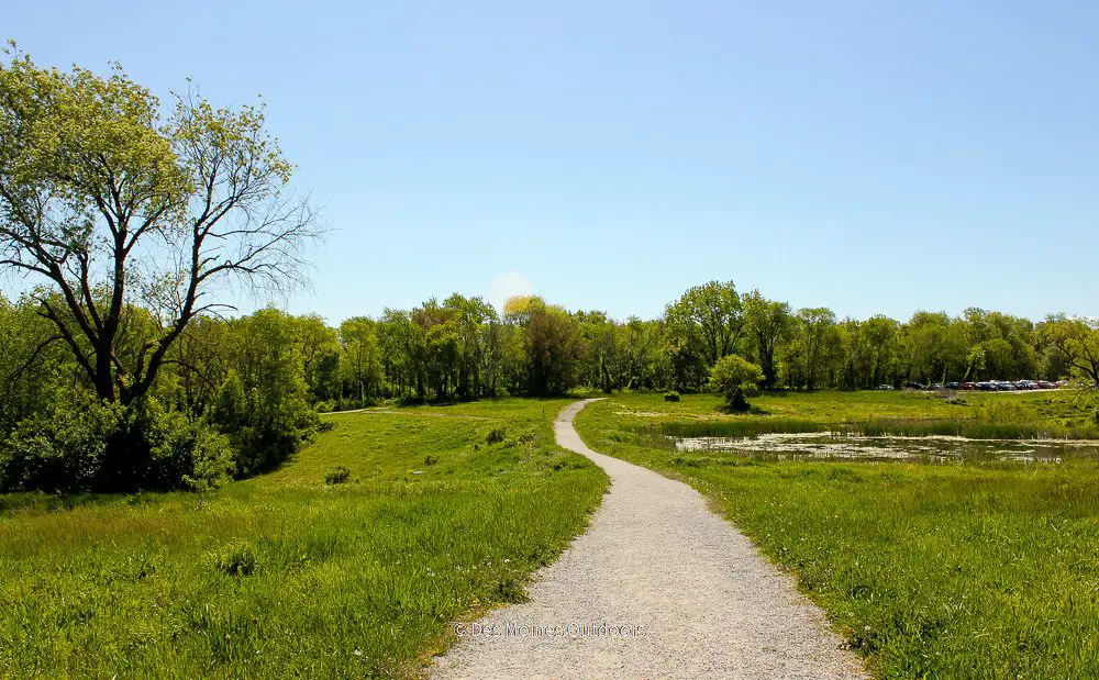
Trails are a popular feature of Fort Des Moines Park. All trails are relatively easy, and two paved trails are accessible from parking areas. The soft-surface nature trail is a favorite for visitors wanting to explore the woods. See the trails section below for more on the trails.
Have a picnic
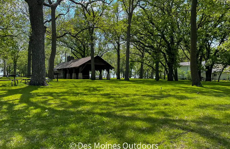
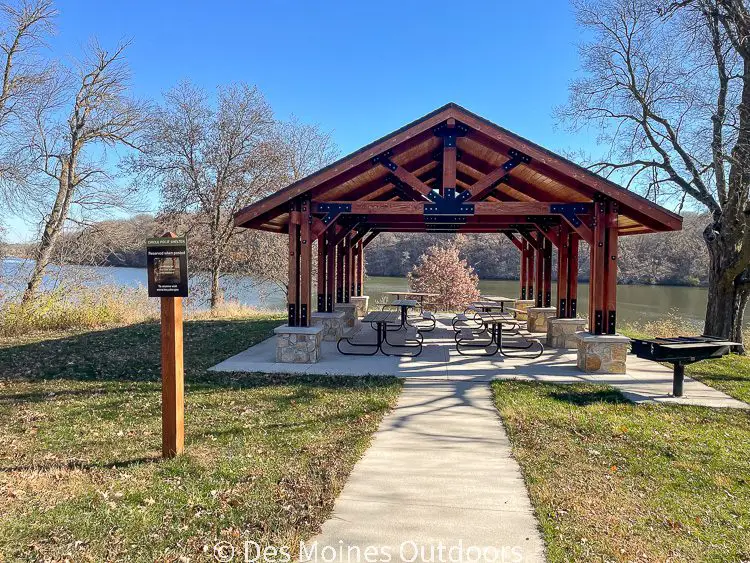
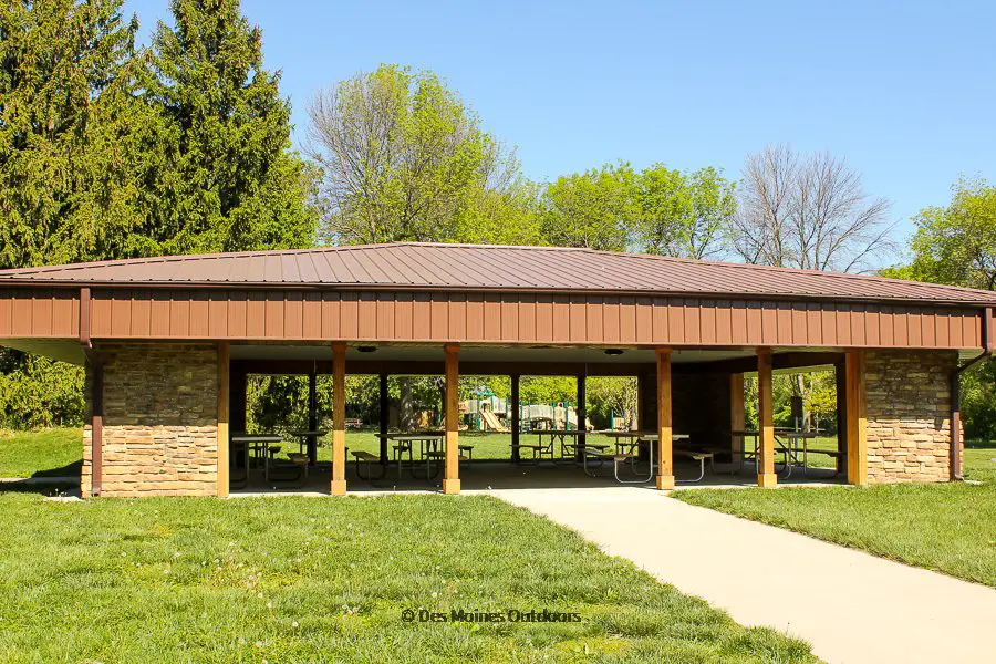
Several picnic tables and grills are located throughout the park, with three excellent 3-season shelters available. The shelters are available for rental and otherwise available first-come, first-serve.
Shelter #1 is near the main entrance and offers easy access to the pond and boat ramp, with a large grassy area nearby. The shelter is ADA accessible, with accessible restrooms not far away.
The kids will love Shelter #2’s proximity to the playground. And adults can play on the neighboring volleyball court. It’s surrounded by shade trees and near the arboretum. Accessible restrooms are nearby.
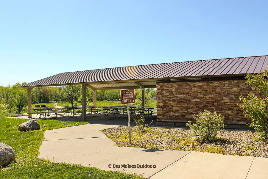
The wood-burning stone fireplace at Shelter #3 is excellent on chilly fall days! It’s relatively new, offers seating for up to 140 people, and is on the park’s southwest corner. Hiking trails and access to the pond are within walking distance. The shelter is ADA accessible and has modern restrooms nearby.
Go fishing at the pond
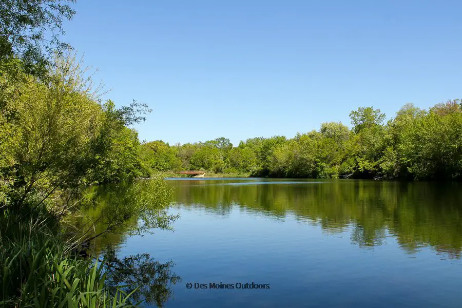
The 14-acre pond at Fort Des Moines Park offers excellent fishing options, from shore or by boat. Part of the pond is even shallow enough for fly fishing. Anglers will catch a variety of fish, including Bluegill, Crappie, Bass, and Catfish.
Find the boat ramp near Shelter #1, not far from the park’s main entrance.
Tour the arboretum
A self-guided tour through the 1.5-acre arboretum features the native trees of Iowa. Tree markers help visitors identify and learn about native trees. And if you’re trying to decide what trees to plant, the arboretum will show you all the options!
Paddle the pond
Bring your canoe or kayak for a relaxing day on the pond. The peaceful surroundings and mature woodlands make you forget you’re in an urban park! The boat ramp is near Shelter #1, close to the park’s main entrance.
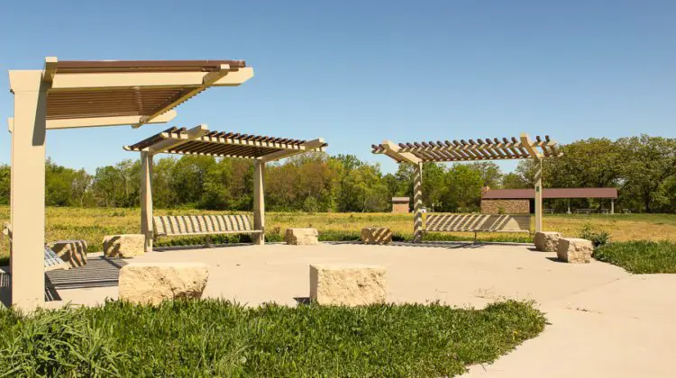
Visit the outdoor classroom
The outdoor classroom is near Shelter #3, surrounded by the Praire Trail loop. It showcases around 18 acres of restored prairie and wetland. Polk County Conservation sometimes offers nature programs there.
Trails in Fort Des Moines Park
Visitors enjoy hiking all three trails throughout the park. And with connector trails at SE 5th, McCombs Middle School, and Studebaker Elementary, it’s easily accessible by foot. All trails are relatively short and easy, great for all levels of hikers.
Lakeside Trail is a 1.1-mile paved/gravel trail around the perimeter of the large pond. Access this trail from the parking lot near Shelter #1 or Shelter #3.
Prairie Trail is a .0.5 mile paved loop around the outdoor classroom on the park’s southwest corner. Access is near the parking lot by Shelter #3.
Savanna Loop Trail is a 0.7-mile loop trail on the park’s southeast corner. This loop is a soft surface nature trail that winds through the woodlands of the park. Access this trail from Lakeside Trail, near the southeast corner of the pond.
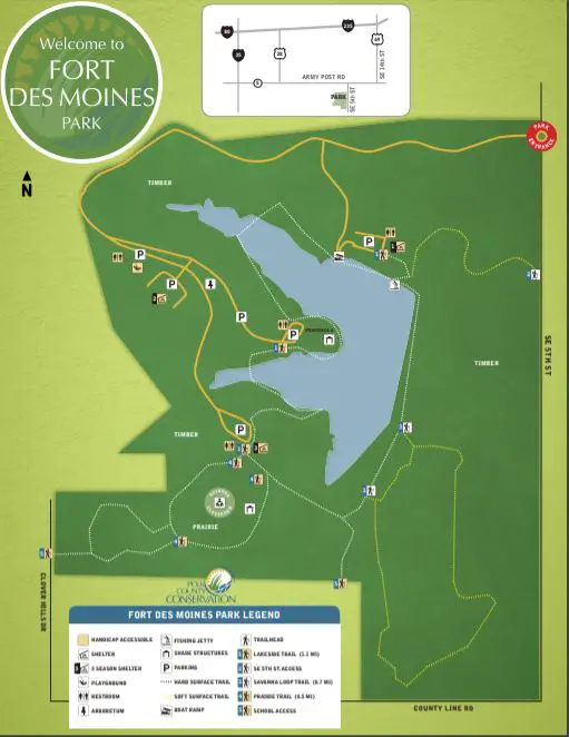
Fort Des Moines Park Map
Things To Do Nearby
After a walk on the trails, head to Blank Park Zoo to learn about the zoo animals and get a bite to eat at the Safari Grill! Just two miles northwest of the park, this 22-acre zoo is a favorite among kids and adults alike.
Ewing Park is 3 miles northeast of the park. The Lilac Arboretum, Children’s Forest, BMX track, and disc golf are a few of the features in this one-of-a-kind park.
Easter Lake Park is 10 minutes northeast of the park. There you’ll find a 178-acre lake, trails, a covered bridge, a swimming beach, and much more!
Skate South is less than a mile south of Fort Des Moines Park. The family-friendly roller skating rink offers half-price nights and skate rentals too! Check their calendar for hours and prices.
Just 6 miles northwest of Fort Des Moines, off of Fleur Drive are Des Moines Water Works Park and Gray’s Lake Park. They offer a ton of outdoor activities on over a thousand acres of parkland and trails near downtown.
Visit Fort Des Moines Park Today!
Fort Des Moines Park is located at 7200 SE 5th St., Des Moines, IA 50315.
From I-235, take Exit 9, and turn south on NE 14th Street. Take a right (heading west) on E. Army Post Road and then turn left (heading south) on SE 5th Street. The park entrance is on the right (west) side of SE 5th Street.
From the Highway 5 Bypass, take Exit 96 and head north on SW 9th Street. Turn right (east) on NW 98th Avenue and left (north) onto SE 5th Street. The park entrance is on the left (west) side of SE 5th Street.
Summer park hours (April – October) are 6:30 am – 10:00 pm. Winter park hours (November – March) are sunrise to sunset. Free parking is throughout the park, with parking lots at each of the three shelters. Restrooms are near Shelter #1, Shelter #3, the playground, and the peninsula parking area on the pond’s west side (see map).