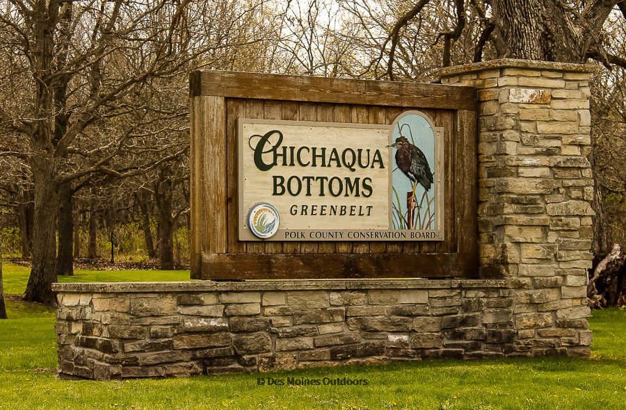
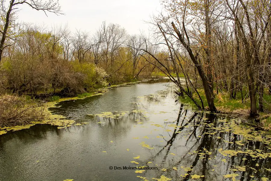
Chichaqua Bottoms Greenbelt is possibly one of Des Moines’ best-kept secrets! It’s a grandiose 9000+ acre greenbelt that extends along 10 miles of former Skunk River oxbows. The area boasts diverse landscapes, habitats, and wildlife rarely seen in Iowa.
It’s about 20 miles northeast of Des Moines and has a wide array of outdoor activities. Camping, canoeing, hiking, and hunting are a few of the things to do at this extraordinary park.
A Brief History of Chichaqua Bottoms Greenbelt
In the early 1900s, the Skunk River in northern Polk and Jasper Counties got rerouted (i.e., straightened) to make the flood-prone area more farmable. That cut off several miles of river oxbows that now make up the Chichaqua Bottoms Greenbelt.
Polk County Conservation first obtained the parkland in 1960 to renew and protect the old Skunk River oxbows. Since then, they’ve formed partnerships to acquire more of the surrounding land. And they’ve done fantastic work preserving and reconstructing prairie, wetlands, and native woodlands. They’ve also re-introduced wildlife species that thrive in the habitats of the park.
Fun fact: The name “Chichaqua” (pronounced cha-chak-wah) is what local Native Americans called the river. Early French settlers thought the word meant Skunk (thus the Skunk River Valley!). They were close. But now it’s believed the term referred to the smell of wild onions growing along the river’s shores.*
Things To Do at Chichaqua Bottoms Greenbelt
Watch Wildlife
Chichaqua is home to a wide variety of wildlife, including sandhill cranes, river otters, ornate box turtles, and much more.
Birdwatching is a popular (and fruitful) activity at Chichaqua Bottoms. It’s designated as an Iowa DNR Bird Conservation Area and deemed an Important Bird Area by the Audubon Society. A bird blind is along the main park road (NE 126th Ave). Be sure to check out this field checklist from the Iowa DNR on the many (many!) birds you could see there.
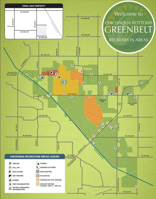
You’ll also want to check out the wildlife viewing platform. It’s a couple of miles south of the main visitor area, off Hwy 65/NE Hubbell Ave (see map).
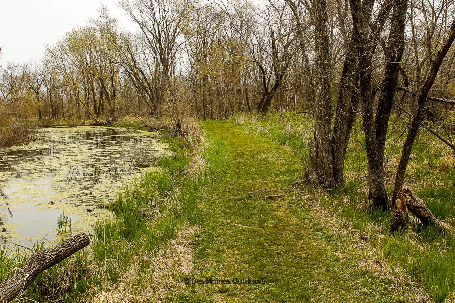
Hike the Chichaqua Bottoms Greenbelt trails
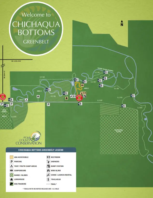
The park has over four miles of excellent hiking trails through old river oxbows, prairie, woodlands, and marsh. There’s no better way to experience nature here. You can access all three of the trails near the campground and historic bridge.
Cardinal Flower Trail is an easy .8-mile loop trail near the campground, at the historic bridge. The trail follows the oxbows with lots of opportunities to spot wildlife in and out of the water.
Otter Trail is an easy 2.6-mile trail that starts off the south side of the Cardinal Flower Loop. From there, it heads east and south before it turns back north to loop back near the waterfowl blinds. The last segment turns west and ends at the road near the office and campground (or you can loop back to where you started). Check the map before heading out. The trail is usually closed from September 1 to the end of the waterfowl hunting season.
Jack Pine Trail is an easy .9-mile trail, starting at the bridge and extending west along the river. It ends on the west side of the park near the entrance.
Canoe or kayak the backwaters
Canoe and kayak three miles through the old Skunk River oxbows—you’re almost guaranteed to see wildlife! Boat rentals are available at the park office. Call 515-249-5925, and check out the Polk Co. Conservation website for more information.
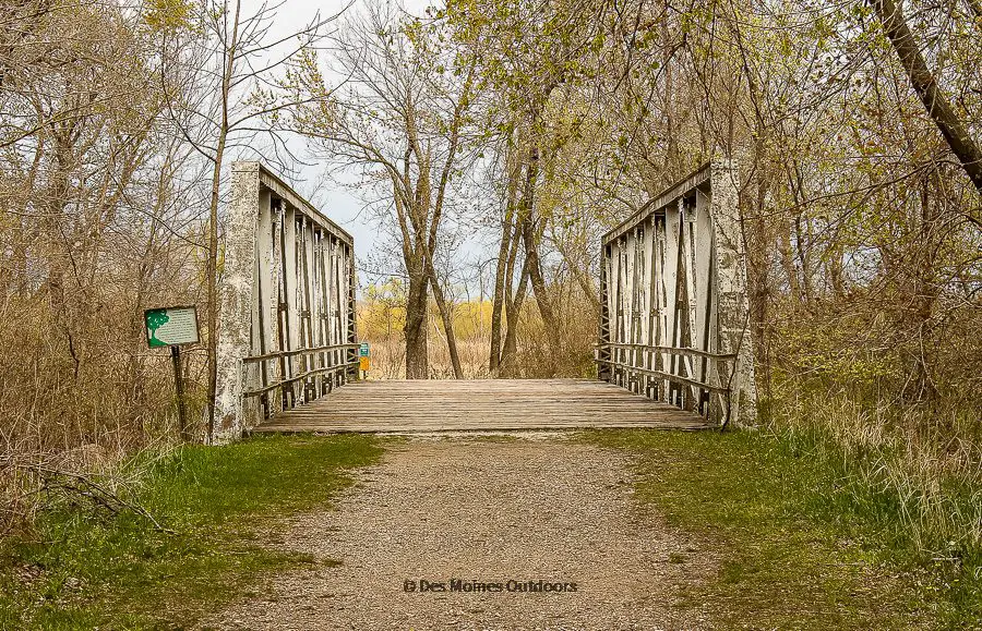
Check out the historic bridge
The 100-foot long historic Warren pony truss bridge is one of the last of its kind. In 1992, it got moved from the main channel of the Skunk River to Chichaqua Greenbelt. You can find it near the campground. The three main hiking trails are accessible near the bridge.
Go camping
The campground has ten electric sites and two non-electric sites. Five tent sites are available, as well as a youth tent area. The youth tent area is reservable, but all other campsites are first-come, first-serve. The campground has a modern restroom/shower building, water, and a dump station.
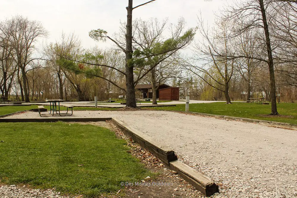

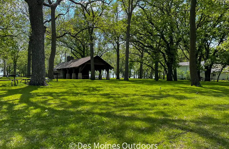
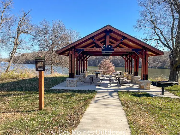
Picnic
This park is the perfect place to have a picnic and bask in the peaceful surroundings of nature. Picnic tables are scattered throughout the park. Charcoal grills are also available.
Cross Country Ski
Trails get groomed for cross-country skiing in the winter. They start at the campground and follow the old Skunk River oxbows. Rent skis (and snowshoes) from Jester Park’s Outdoor Recreation and Wellness Center.
Fish
Shore fishing is a great activity at Chichaqua, with plenty of fishing spots to choose from. It’s a fun place for the kids to catch catfish!
Hunt
Hunting is allowed in many areas of the park, and some areas are designated hunting areas. A controlled waterfowl hunting program is in place; blinds are for rent seasonally (by reservation only). A trap range with a trap house (shot shell only) is also available for rental.
To reserve a blind or trap range, call (515) 967-2596. For more information on hunting, please see the Polk Co. Conservation website.
Dog Training
Dog training is allowed year-round on 100 acres designated for this purpose. Trials are held there each year. For more information and training rules, go to the Polk Co. Conservation website.
Park Maps
Things to Do Nearby
Thomas Mitchell Park is an excellent county park 17 miles to the south. There you can hike, camp, fish and more! One of the parks’ highlights is Camp Creek, which is usually low enough to walk and explore.
Access the 26-mile Chichaqua Valley Trail, about 9 miles south in Bondurant. The paved trail extends from Berwick to Baxter, over farmland, creeks, and the Skunk River. Trail users enjoy the rail history and stopping in the small communities along the route!
Ashton Wildwood County Park is a 113-acre park about 10 miles east of Chichaqua Bottoms. This small Jasper Co. park has tent camping, the Ashton Observatory, and an orienteering course.
Ankeny is about 15 miles west of the park, and Altoona is 15 miles south. Both towns have a variety of restaurants and shopping.
Visit Chichaqua Bottoms Greenbelt Today!
Chichaqua Bottoms Greenbelt is at 8700 NE 126 Ave, Maxwell, IA 50161.
From Des Moines, head north on I-35 to Exit 96 (Elkhart/Polk City). Turn right (east) onto NE 126th Ave for five miles. Turn left (north) onto NE 72nd St, which turns into NE Yoder Dr. Continue right (east) onto NE 134th Ave. Turn right onto NE 80th Ave and continue left onto NE 126th Ave through the park.
Park hours are 6:30 am to 10:30 pm. Free parking is available in several areas off the main park road and in the campground/office area. Restrooms are at the office and campground.
*Reference: Chichaqua Valley Trail. NRT Database. https://www.nrtdatabase.org/trailDetail.php?recordID=3498#three